Mile 1.6: Kassler Center
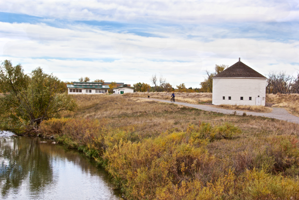
Established in 1901, Kassler was a company town founded by the private company that preceded Denver Water. The company completed the Kassler water treatment plant in 1907 which used the “English” slow sand filtration system to deliver water to a growing region. In 1979, Kassler was designated a national waterworks landmark as it was the first sand filtration system west of the Mississippi. Today, many of the original historic buildings remain and will be part of an interactive educational exhibit. Check with Denver Water for tour opportunities. For an online interactive tour of the Kassler Center, click here.
Mile 14.88: Intersection with C470 Bikeway/Centennial Bike Trail
After passing through Fly’n B Park, the site of a historic homestead built in 1906, the Canal meets up with the Centennial Bicycle Trail which follows C-470 to Waterton Canyon to the west and the Cherry Creek Greenway near Parker road to the east.
Mile 24.5: Dekoevend Park
Dekoevend Park is an extremely popular park managed by the South Suburban Parks and Recreation District. The park has a variety of different fields, tennis courts, bleachers, a playground and group shelters as well as the Goodson Recreation Center. The High Line Canal skirts the edge of the park and is a popular running and walking spot for nearby residents.
Mile 33: Blackmer Common
Blackmer Common lies adjacent to the private Kent Country Day School. The open space was donated by the school and will remain protected open space. With sweeping views of the Front Range and gently rolling hills, this is a popular spot for wildlife enthusiasts and walkers.
Mile 44.47: Intersection with the Cherry Creek Trail
The High Line Canal intersects the Cherry Creek Trail here at the Cherry Creek Golf Club. The Cherry Creek Trail runs north to downtown Denver and south to the City of Parker. This hard surface trail is extremely popular with cyclists.
Ride your bike to this location as there is no developed parking lot to access the High Line Canal.
Mile 54.25: Delaney Farms
After the Chambers underpass, the High Line Canal loops around Delaney Farms, designated open space in Aurora. The open space contains multiple historic structures, some moved from their original locations. The homestead and the white barn are on the National Register of Historic Buildings and the white barn is the last of kind in Colorado. It was built in approximately 1900 and served originally as grain storage but then as a dairy barn. The open space also has a sizable prairie dog population and a disc golf course in the eastern section of the park.
Mile 59: Star K Ranch Open Space
The High Line Canal skirts the southern edge of the 280 acre Star K Open Space. This respite provides homes for mule deer, painted turtles, snapping turtles, red-tailed hawks, American kestrels, western meadowlarks, great horned owls and blue jays. Shady soft surface trails connect the High Line Canal to the Sand Creek Greenway, a 14 trail system that connects to the Westerly Creek Greenway and the South Platte River Greenway. Star K Ranch Open Space is also home to the Morrison Nature Center which hosts exhibits on local plants and animal life.
Mile 62.4: Dry Dock Brewery
The High Line Canal wanders through an industrial area of Aurora along Tower Road. The Canal goes behind Dry Dock Brewery, Aurora’s first microbrewery. Dry Dock has been awarded more than 20 medals from the Great American Beer Festival and has a disc golf course and tap room that borders the Canal.