The Canal was built in 1883 – imagine all the historic sites that exist along its 71 miles!
Thanks to funding from the Colorado Parks Foundation, the High Line Canal Conservancy was able to commission a limited reconnaissance survey and prioritized survey plan for historic resources along the High Line Canal corridor. Barbara Stocklin-Steely of Square Moon Consultants, LLC., the selected consultant, talks to us about their process that led to the 122-page report outlining priority historic resources along the Canal.
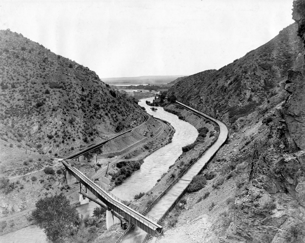
How does one undertake a historic property survey of the High Line Canal—a 130-year-old ditch that winds its way over 71 miles and four counties—with limited time and resources? The answer: GIS-based data analysis, targeted historical research, and bicycles.
The High Line Canal Conservancy initiated a historic property survey of the High Line Canal in the summer of 2016 using a grant from the Colorado Parks Foundation. The survey was intended to paint an overview of the types and numbers of historic resources located both within and adjacent to the Canal. A primary focus of the study was the historic infrastructure of the Canal itself – its check dams, head gates, turnouts, weirs, flumes, and laterals. But, the survey also looked at individual properties and landscapes that historically relied on the Canal’s waters, including farmsteads, residences, golf courses, and cemeteries.

Technology was the cornerstone of the survey project. Using GIS data from the National Hydrology Dataset, County Assessor records from 1938 or earlier, and bridge and road data, the study identified nearly 200 structures and buildings within 500 feet of the centerline of the Canal. Through a point-density analysis, this information was mapped and found to be concentrated across 9 (highlighted in red) Canal segments, comprising 33.5 miles of the Canal corridor.
The historical research phase of the project looked at previous records on file at History Colorado through “Compass.” the state’s database of previously recorded historic resources. After looking through this database, the project earmarked 32 previously recorded properties that warranted a second look. These resources encompassed a broad range of properties, including bridge abutments, farmsteads, residences, and building foundations. The state provided GIS data on these 32 resources, and this information was added to the project’s database. An examination of historic maps from the United State Geological Survey, photographic files from the Denver Water Department, and archival records in several county depositories also helped to identify other potential historic properties along the Canal’s extent.


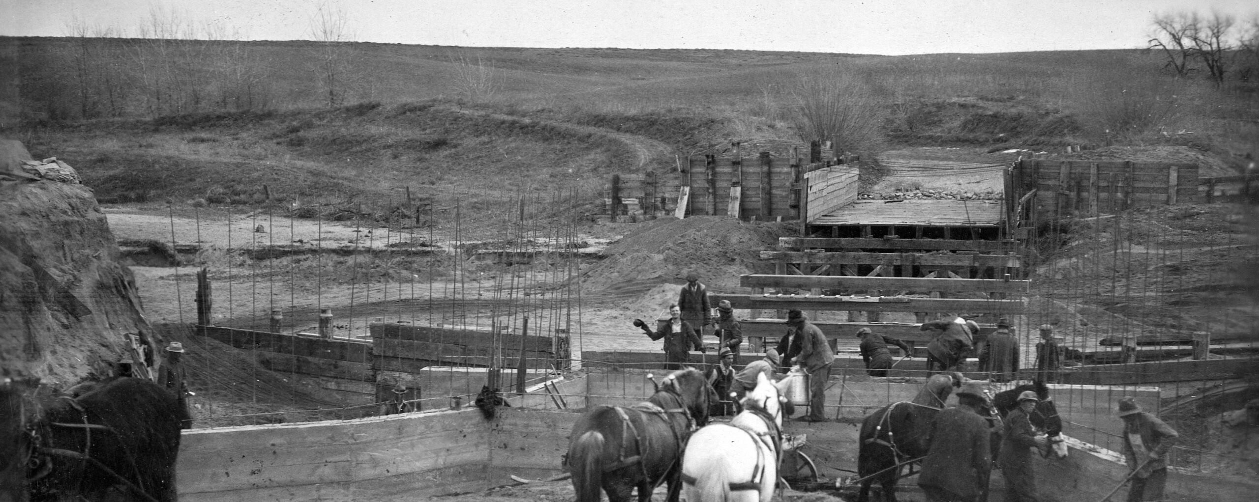
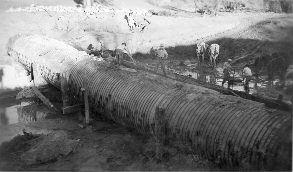
Surveyors used bicycles to cover the 33.5 miles of high-priority Canal corridor, and other high-priority resources identified during the project’s historical research phase. Bicycle travel typically occurred on the Canal’s improved recreational trails, with surveyors using hand-held computer devices to locate and record properties. In all, 191 historic properties were documented, including everything from 4 flumes, a Canal ditch-rider’s house, the historic Alum House Gatehouse, and several notable late 19th to early 20th century farmsteads, such as the Miksch-Helmer Cabin and Plews Ranch in Douglas County, and the Delaney Farm in Arapahoe County.
The High Line Canal was built by the Northern Colorado Irrigation Company, a subsidiary of the Colorado Mortgage Company, from 1879–1883. This English-owned Company acquired leftover land from the Kansas Pacific Railway, and repackaged and sold this land to farmers, along with water rights from the newly constructed High Line Canal. While the Canal brought many settlers and farmers to the Denver Basin, it did not fully meet its potential. Because of a myriad of issues, including a low water right from the South Platte River, engineering troubles, and water seepage along the Canal’s extent, the Canal never fulfilled its promise of ample water and irrigation for thousands of acres along the Canal. Nonetheless, for many who lived along the Canal in the late 19th and early 20th centuries, the Canal was essential to everyday life and survival.
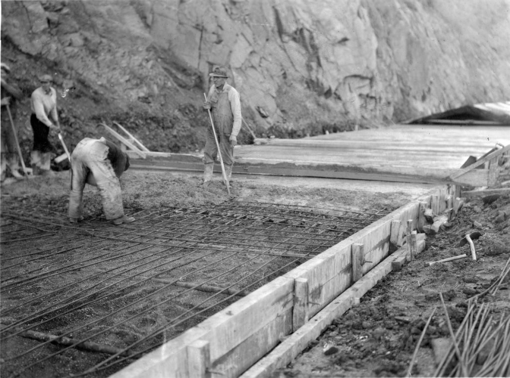
This initial survey reminds us of the 130-year-old Canal’s history, the incredible engineering and construction endeavor required to build it, the infrastructure and army of workers required to maintain it over the decades, and the significant impact this 71-mile earthen Canal has had on the agricultural production and settlement of the Denver Basin, despite the Canal’s many historic shortcomings. Today, the Canal is a rare survivor from an earlier age, serving largely as a recreational refuge for the Denver region, with little publicly known about its long and rich history.
This initial study lays the groundwork for additional survey, preservation and interpretative efforts along the Canal. This effort is important since these rare surviving historical artifacts help to tell the rich and varied stories of the Canal – of pioneering settlers drawn to the promise of agricultural prosperity, of English capitalists who failed to understand scarcity of water in the arid American west, and of hard-working ditch-riders who worked tirelessly to keep the malleable earthen ditch system free of debris and functional for its users. The remaining silos, farmhouses, flumes and gauge houses provide valuable opportunities for interpreting and sharing this history with the public, for enhancing the user’s experience along the Canal trail, and for preserving historic resources to serve future generations of Canal users.
Barbara Stocklin-Steely, MSCRP, established Square Moon Consultants, LLC, a historic preservation and planning consulting firm, in 2016. Using her 17+ years of local historic preservation experience, Barbara helps her private sector, non-profit and public sector clients identify and preserve historic properties, navigate government review processes, and find creative solutions to historic preservation issues. Click here for more information.