Enjoy a walk or bike ride in the rolling foothills of Douglas County (and give us your feedback)!
This content has been developed for the future High Line Canal map and guidebook. Please feel free to contribute any comments or questions as we work to finalize the content of the guide.
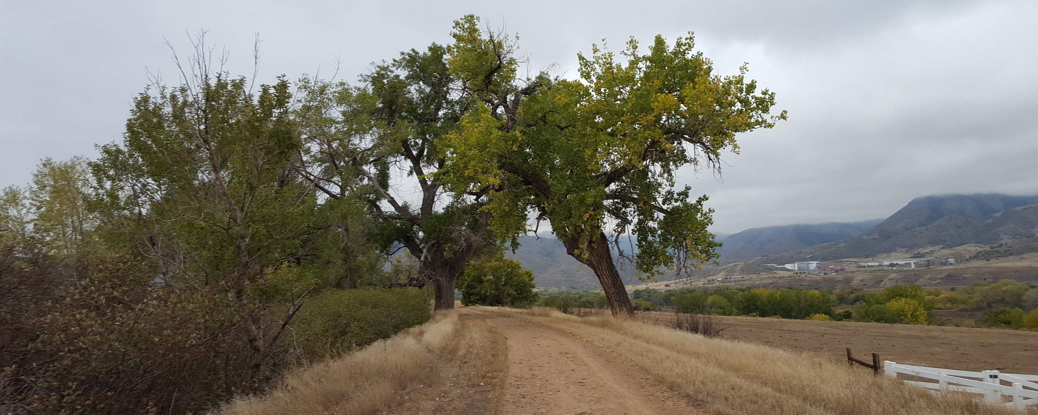
The Trail’s Beginning: Miles 2-6
Rolling Foothills
A pleasant walk through the rolling foothills, you’ll begin moving along the trail with the Canal channel always at your side. Denver peeks up off in the distance as you make your way through this rural section of the Canal where you’ll often see horses and horseback riders.
Distance: 5.5 miles one way
Trail surface: Dirt
Trail cautions: Trail is sandy and deeply rutted in sections – road bikes not recommended.
Trail facilities: Portable restroom at Roxborough Park Road
Parking: Parking lot at High Line Canal Trailhead: 10401 W. Waterton Road, Littleton 80125
Jurisdiction: Douglas County Parks and Trails
Highlights: Platte Canyon Reservoir (2.0), Historic Homestead (3.0), Chatfield State Park (2.3), Lockheed Martin, Mammoth Fossil site (3.0), longhorn cattle
Route Notes
Start: High Line Canal Trailhead, 10401 W. Waterton Road, Littleton 80125
End: Roxborough Road Trailhead, 11490 Roxborough Park Road, Littleton 80125
To start your journey, park in the official High Line Canal trailhead parking, amble up the ramp to the trail, and begin your official journey on the soft-surface trail. Be sure to close and lock the two gates you’ll encounter along the way.
Mile Notes
2.0 Right after you start your journey and before Mile Marker (MM) 2, you’ll notice some hardware along the trail. Look for two large screws atop a cement platform. If there’s no water in the Canal, you can see in its bed a set of parallel concrete mini-walls with curved entries. As the water in the Canal leaves the sluice from the canyon, it goes through this contraption to remove debris and silt. The detritus and water overflow divert to the north either into the Platte Canyon Reservoir or the diversion back to the Platte River. This area was designed by one of the first ditch riders, George Swan, and is known as the Swan Traps.
In the Platte River Reservoir area, watch for redhead ducks, buffalohead ducks, Canada geese, goldeneye, coots, mergansers, kestrels and grebes. You may also see golden eagles, bald eagles and red-tail hawks.
Be sure to close and latch the gates which control the free-ranging livestock, and be sure to safely use the pedestrian and horse crossing lights at Rampart Ridge Road and Titan Road.
3.0 After passing over Willow Creek, stop and take in the view. You’ll see three distinct time periods that reflect intense history of this area. First notice to the north the white hogback ridge along the foothills where dinosaurs roamed. Off across the ridge to the east, you’ll find the archeological findings of the Lamb Spring Archaeological Preserve. In 1960, Charles Lamb uncovered this site which include over 30 Columbian Mammoths, the largest number known from any site in Colorado. It also contains the remains of Ice Age camels, horses, sloths, llamas, and wolves. Along the trail just above the bend at Willow Creek, you’ll see the historic Miksch-Helmer cabin, built in the early 1880s. To the north, you’ll see the Lockheed Martin development complex, where Titan rockets were originally manufactured. (Thus, we have Titan Road!)
Amos C. Miksch, who served as a private in the First Cavalry Regiment of the Colorado Volunteers, witnessed the Sand Creek Massacre. Later he testified that the engagement was in fact a massacre, finger pointing that Colonel Chivington ambushed the Arapaho and Cheyenne tribes. Because of his service in the Union Army, Miksch received a patent for 160-acres where he built this cabin and improved the land with stable, corral, chicken house, cellar, milk house, fenced twenty acres, dug a well and irrigation ditch. He sold the property to Frederick Neumyer in 1873, whose family owned and ranched it for over 100 years, growing wheat, rye and hay. The cabin is hand-hewn logs made from Douglas Fir and Ponderosa pine that are laid with a square notch technique.
5.0 The trail passes through the Cottonwood Riding Club, established in 1985, which houses the Denver Polo Club. Be sure to yield to horses as you make your way through this property. This property is the first property along the Canal to use the High Line’s water via head gate number 7.
6.0 Solstice is a planned community of about 1,100 single-family homes. Developers have plans to build a community park around the Canal’s banks keeping the trail natural and open to the public.