High Line Canal Trail Overview
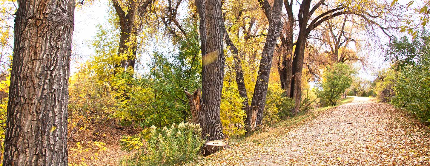
The High Line Canal and its trail, at 71 miles long, run from Waterton Canyon to Green Valley Ranch, just south of Denver International Airport. Zigging, curving, and zagging, the trail of asphalt, concrete, and soft surface gravel, meanders through rural, urban and suburban Denver and Aurora. Only falling 200 feet over its entire length, the historic trail, an old ditch rider’s road, is relatively flat and easily traversed by walkers, runners, hikers and cyclists. Portions of the trail are also suitable for equestrian use.
71 miles from the foothills to the plains…
The southern half of the Canal (miles 0-36) features the foothills and panoramic front range views. The majority of trail surface is soft surface gravel with intermittent patches of concrete. The trail’s pathway is relatively straightforward, winding through rural and suburban backyards, though trails gaps exist at Mile 10 (Plum Creek) and Mile 13 (S. Santa Fe Blvd.).
The northern half of the Canal (miles 36-71) features the prairies and vast grassy views, amid its pathway through older neighborhoods and new burgeoning communities. The northern half of trail is mostly hard surface, with a combination of asphalt or concrete. In some areas, the trail in the northeast may not appear obvious, but work is underway to fill in the gaps and to build a new trail for a continuous 71-mile-long greenway experience.
Refer to the Map & Guide for the High Line Canal for current navigational and detour information.
When Should You Hike the High Line?
You can hike the Canal trail year-round. The trail runs through 11 jurisdictions and all are excellent at clearing and maintaining the trail in all weather and seasons. These jurisdictions include Douglas County, Highlands Ranch, Littleton, Centennial, Greenwood Village, Cherry Hills Village, Denver, Arapahoe County and Aurora. Whichever time of year you choose, be sure to explore the trail on foot. It’s an intimate experience that allows you to enjoy a ‘slice of nature in the city from a pedestrian’s point of view and the seasonal beauty of Colorado.
How to Hike the High Line Canal Trail Your Way
Most people can’t walk all 71 miles in one attempt, especially since camping is not allowed along the trail. You’ll need to make a plan for how you’ll walk the entire trail. We’ve broken the trail up into four ways (below) on how to hike it.
No matter how you hike the trail, you’ll want to own a copy of the Guide to the High Line Canal. The Guide is essential for a successful hike. Not only does it come with a separate fold-out map and segment maps within the booklet, but it also provides trailhead and parking info, restroom locations, and other helpful navigational tips for your hike. You’ll also find amazing Canal history and fun nature facts to make your outings more enjoyable. Visit highlinecanal.org/guide to purchase yours today.
Options for Breaking Up the 71 Miles:
- The Short and Sweet option in 27 segments (2-4 miles apiece per the Guide to the High Line Canal)
- The Medium and Enjoyable option in 14 outings (5-8 miles apiece. Curated by Chris Englert, Denver By Foot)
- The Connie Brown Way option in 12 outings (4-11 miles apiece. Created by Connie Brown for Walk FOR the Canal in 2020)
- The Long and Thorough option in 8 outings (8-10 miles apiece. Curated by Chris Englert, Denver By Foot)
Which Direction Should You Go?
You can hike the High Line Canal trail in either direction! Some folks favor walking the trail from the northern end at Green Valley Ranch to its southern end at Waterton Canyon. In this direction, you’ll have the front range in your view almost the entire time. Other trail enthusiasts prefer walking the trail from its southern beginning in Waterton Canyon to its northern end near the airport because they want to walk in the direction in which the Canal’s water historically flowed. But no matter which direction you choose to go, you’re in for a treat and an understanding of Denver history that you can’t get anywhere else.
How Do I Find Out about Trail Gaps, Closures and Detours?
It’s helpful to remember, the workers who built the High Line Canal never imagined it would be used for recreation. However, today nearly 130 years later, the historic waterway has become a popular ecological and recreational amenity for walkers, joggers, cyclists, equestrians and nature lovers. While improvements are underway, there are still sections along the Canal where trail gaps exist. There are currently four major trail interruptions. Please refer to page 12 of the Guide to the High Line Canal for a list of locations and how to navigate these trail gaps. Also, before your outing, be sure to check the Conservancy’s Trail Updates page for trail closures and detour information: highlinecanal.org/trail-updates.
What Do You Need to Hike the High Line Canal Trail?
You’ll need a few things to have a comfortable hike on the trail.
- Map & Guide to the High Line Canal. To order online, visit highlinecanal.org/guide. An indispensable tool for discovering the wonders of the historic trail. The Guide breaks down the 71-mile linear park into 27 walkable and bike-friendly trail segments. Enjoy navigational tips and highlights of the Canal’s history and natural wonders, highlighting access points, parking, landmarks and connecting trails. The Guide is also available at most local REI and Tattered Cover stores. Cost: $24. All proceeds benefit the Conservancy’s mission to preserve, protect and enhance the High Line Canal.
- Shoes: To walk the High Line Canal Trail, you just need a good pair of walking shoes, or for shorter stints on the trail, sandals are fine. Be sure your sandal though is closed-toe to bar against pebbles or goat heads. Boots aren’t necessary unless the weather requires them. In the winter, you’ll want to wear a closed-toe hiker, and you might want ice cleats, but this is a rare requirement. In the winter, the trail is also a great place to snowshoe and cross-country ski if enough snow has fallen.
- Water & Snacks: For water, carry at least two liters. Water can be hard to find along the trail. Snacks are always a good idea when hiking!
- Hat: On your head, make sure you’ve got a good hat for either sun or warmth. There are sections where shade is at a premium, and you will want protection from the bright Colorado sun.
- Pack: In addition to the above, you might optionally want to throw in a pair of gloves, sunscreen, the ten essentials, and maybe even a pair of binoculars. Wildlife is always within view.

Read These Books Before You Hike the High Line Canal Trail
Prior to walking the Canal or during your 71-mile trek, there are a few books that will enhance your experience.
- The Thunder Tree by Robert Michael Pyle
- The Best Urban Hikes: Denver by Chris Englert
- Ditch in Time by Patricia Limerick
- The High Line Canal Conservancy‘s Trail Guide. This Guide breaks the Trail into smaller 2-3 mile segments.
Post and Share Your Story
As you’re hiking the High Line Canal Trail, be sure to post your photos so we can see them. Use the hashtags #highlinecanal #71Miles, and tag us on Instagram @highlinecanal, Facebook @highlinecanalconservancy, and Twitter @COHighLineCanal.