A guest blog post by Chris Englert from EatWalkLearn.
Chris Englert walked with 55 community members along the Canal, 7 of whom walked all 71 miles with her. Here’s a recount of their journey.
A Journey Begins
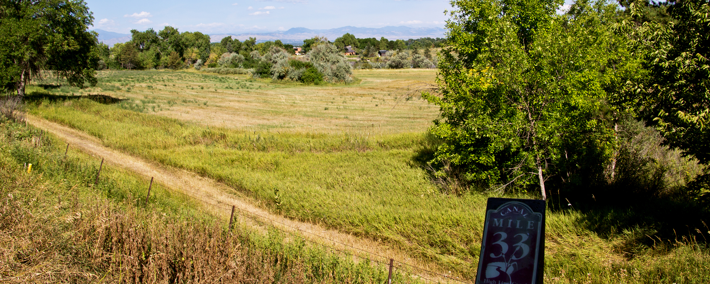
Walking 71 miles is no small feat. In order to create an enjoyable experience for anyone willing to take on the task, we broke the High Line Canal Trail’s 71 miles into 11 segments averaging 6 miles a piece. Our shortest was 3 miles; the longest was 11. But it wasn’t the length or the amount of steps that made our journey successful, it was the connections and the friendships we developed as we experienced every foot of the 71 miles of the High Line Canal.
An Infinite Amount of Joy
Originally, our band of adventurers was 26 eager High Liners. By the time we reached the end of the trail, we were 7. Multiply our joy and love for the Canal that developed as we walked, and that number is infinite. What were the best parts? Worst parts? Favorite parts? Those answers are different for everyone, but I’ll do my best to point out a few.

The Beginning Starts at the End
The High Line Canal ends quietly, barely noticeable in Green Valley Ranch, just south of Denver International Airport. A slight rise in the topography out in the plains calls out the High Line Canal, but only a guide would be able to spot it. For its first five miles, it camouflages behind a subdivision while builders grow Denver to the north. In a few years, a trail will appear where the High Line traverses, but for now, white poles mark its subtle disappearance.

From Subtle to Hello!
The Trail starts to get its personality around mile marker 66. It appears as a sidewalk through Green Valley Ranch and meanders through Green Valley Golf Course. Here is where High Line Canal Trail signs start to beckon the adventure. Wide open views of the Rocky Mountains invite High Liners down the Trail, encouraging them to brave Tower Road and the I-70 crossing. Just south of the crossing, the Trail becomes grass and journeys through its first disc golf course behind Dry Dock Brewery and over train tracks.
From Rural Aurora to Urban Aurora
Crossing Colfax, Denver’s longest street of life, love, and loss, the Trail parallels and then crosses Colfax again, making a turn northward over Airport Road and into Norfolk Glen. The Glen surprises with hawks and deer, but then it dumps High Liners back across Colfax for a third time into the Aurora neighborhood. Here begins a long journey through Aurora, where the Canal plays protagonist to Aurora’s history of water and survival.
While ambling south through Aurora, the Canal’s longtime friend, DeLaney Farms, invites High Liners to amazing views of prairie dog habitat, fields, and cottonwoods. At the same time the experience harkens back to the original needs the Canal provided; watering the farms that feed Aurora. Here is where the local community of the Canal starts to show up with walks, rides, and strolls. Passing the Aurora Governmental Center with its fabulous public art only adds to the invite of engaging with this walking treasure.
Denver Weighs In
In no time, the 58 mile marker shows up and invites you to pass under I-225, past Del Mar Park, Aurora Hills Golf Course and along Windsor Gardens. For the first time, the Trail begins to invite folks to sit in the shade and enjoy the landscaping and place-making provided by the Gardens. The Canal drops water into Windsor Reservoir, which Fairmount Cemetery uses to maintain its historical fields, champions trees and roses. Here, High Liners start to see some of the working elements of the Canal, including a pump house and pumps. After Windsor Gardens, the Trail takes on another personality as if it tries to get away from itself. This area on the Trail cries out for some love and care.
2019 update: Denver Water no longer moves water this far north in the Canal. If you see water in the Canal, it’s from runoff.
After crossing the ghastly Parker at Mississippi intersection, the trail parallels the Canal in a long straightaway, offering a chance to adventure in the Canal itself. Many Canal lovers walk and ride through here, passing under the lovely Iliff tunnel. Here, wonderful views of the Cherry Creek Golf Course invite pensive thoughts as the Canal meanders to its undercrossing at Cherry Creek Trail. A major transit area for biking commuters wakes High Liners out of their pace. Dodging the Cherry Creekers to the south, the Trail crosses Cherry Creek and continues its meandering wander over Yale, twice, until it arrives at Bible Park.
Bible Park provides a nice respite of shade and bathrooms before High Liner’s adventure over Yale again to the major tunnel under I-25. It’s shocking to be so secluded and away on the Trail while at the same time being right in the middle of major traffic and movement. Nevermore than here do High Liners feel the Trail’s magic as it secludes its High Liners from the hustle and bustle of Denver’s city life.
2020 update: A beautiful mural under I-25 exemplifies all that ca be found on the High Line Canal Trail.


From Here to the Beginning, Beauty
Some of the best parts of the Trail lie ahead, and those parts anchor in the history of the Eisenhowers. Mamie, not Dwight, called the Canal home. From Mamie D Eisenhower Park, past Wellshire Golf Course and into the Greenwood Village Neighborhood, the Canal passes wonderful open spaces.
2020 update: A tunnel is under construction to safely move High Liners under Hampden and Colorado.
Apples, asparagus, plums, pears, and an assortment of berries treat High Liners in bountiful supply. The Marjorie Perry Nature Preserves offers the best views of the Rocky Mountains, especially of sunsets across the Preserve.
Not a quick way to transit in Denver, the Trail takes its best twists and turns out of Greenwood Village into Centennial. The Goodson Rec Center appears just in time for a break and some water before letting High Liners pace themselves to Horseshoe Park. Again, surprises appear with crossings over gulches and places to play tennis or just relax under a tree.
Littleton Beams
After leaving Goodson, High Liners tunnel beneath C470 and come upon the surprise of Fly’n B Ranch. Once a truck farm, this respite offers up good fishing for new anglers, restrooms, and community space. Abutted to it, a giant senior facility gets spectacular views of the old farm and the Trail.
Soon, High Liners cross over the scary, unmarked Santa Fe Drive crossing and pass quickly through an industrial area. In no time, views of the foothills to the west and a sneak peek of downtown Denver to the north bid High Liners time until they arrive at Mile Marker 10.
Sadly, a break in the trail occurs here at Mile Marker 10, forcing High Liners to cross the rickety train trestle to the poorly marked trailhead on Santa Fe. (This trestle is no longer there, 2019.)
The next place to access the High Line is at the North Roxborough Road trailhead. From there, High Liners can backtrack and go east and south for two miles to pick up miles 7-9 and see the break in the trail, or they can go west from the trailhead toward Waterton Canyon.
Walking from Roxborough toward Waterton only builds excitement as the Trail comes to an end. But first, High Liners enjoy longhorn cattle on their way past several riding clubs. The cottonwoods become their biggest in this area and the headgates change from orange to blue. Some of the original users of the Canal’s water still remain here. Keep eyes peeled for an original homestead on the left side of the Canal while walking toward Waterton.
The End is the Beginning
The Canal breaks off to the left behind the Kassler Center through a tunnel to its start at the diversion structure on the Platte River, which is currently under construction. (2017 update: No longer, it’s open!)
The trail, on the other hand, veers to the right past the overflow structure, around Kassler Center and up into the Canyon. The Canal and the trail come together again. The trail becomes Waterton Canyon Road, where High Liners continue up the Canyon to Mile Marker 2 in the Canyon, also known as Mile Marker 0 of the High Line Canal trail at the Diversion Dam.
The Kassler Center
As a special treat, our group of High Liners got a private tour of the Kassler Center. Starting off with a slideshow of historical documents and a narrative of water rights in Denver, we then toured the historic filter fields, the garage and the machine shop. In the machine shop we touched old pumps, a safe, and even stood in a cut-out of the wood piping. Next, we toured the Kassler home and the administrative building. Denver Water has plans to renovate and open these buildings for the public, highlighting the role of water in the growth of Denver.
The “Original” High Liners Finish the Trail
Note 2020: In 2016, the first seven High Liners finished the Trail, hiking all the way to the Diversion Dam. They were the only group that did it in 11 sections and had to wait over a year to actually get their coveted High Line Canal 71 Mile Token. We started something that the seven of us have treasured now for five years. Since that time, over 200 have completed the entire High Line Canal and over 400 have attempted. Many more have walked the Trail on their own, and the High Line Canal Conservancy tracks this overall trail usage.
In addition, the High Line Canal Conservancy has grown, finding funding for improvements and improving the Trail. New signage and wayfinding is coming, a stormwater runoff project has begun to water the trees, and more people than ever are hiking the trail.

A Denver Treasure
Having walked the entire 71 miles, the High Line Canal is a treasure that must be polished. It connects hundreds of thousands of folks in Denver, from rural to suburban. All classes, all incomes, all races have the chance to connect with each other. This mosaic along the Canal represents Colorado, and I can’t imagine a better way to build harmony among neighbors than through walking the High Line Canal Trail.